
Backcountry navigation that works where the signal doesn't.
An on-device vector topo that's offline for all 50 states — plus snap-to-trail route planning, ride recording, and off-route alerts. Built for ADV riders, overlanders, and dispersed campers.
Coming to the App Store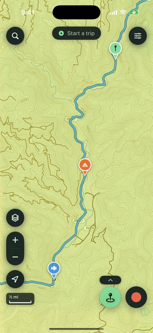
The whole backcountry, in your pocket
A vector topo built to live on your phone — contours, terrain, and public land — with the overlays that matter off-pavement: USFS roads, trails & MVUM, BLM parcels, water, and recreation sites.
An on-device vector base
Second Kick Maps default map is a sage vector topo that's crisp at every zoom and renders straight from your phone — no tiles to stream. Download any of the 50 states for full trail-level detail and contours that work in airplane mode. USGS topo and satellite are there too when you want them.
Layers tuned for the dirt
Per-layer opacity, drag to reorder, and one-tap switches for USFS roads · USFS trails · MVUM · rec sites · fuel · public land. Your map opens with a sensible set already on. Tap any road, trail, or parcel to identify it — including who owns the land — and browse 14,000+ USFS campgrounds, trailheads, and day-use sites bundled in nationwide, no download.
Plan it, then stay on it
Drop points and snap to the road-and-trail network, get the elevation profile automatically, then follow any saved line with off-route alerts that buzz before a wrong turn becomes ten miles. One route can carry options — a spur out to a lookout, or two ways round a hard section — that you decide between on the day.
Capture everything without stopping
Gloves on, moving, bad light — Second Kick Maps is built for the moment, not the desk.
Mark anything, three ways
One tap at your GPS position, long-press anywhere on the map, or just ask Siri — hands on the bars, and it works with no signal. Add photos, notes, icons, and colors; get a multi-day forecast right on the waypoint.
Record the whole ride
Live stats on screen and on the Dynamic Island, pause/resume without phantom miles, then review distance, climb, moving time, top speed, and speed & elevation graphs.
Trips tie it together
Start a trip and every capture collects itself. End it, review everything in one place, keep what matters — and share the whole weekend as one file.
Know the water before you cross it: live USGS river conditions nationwide — flow, stage and temperature for the crossings and camps along your line.
Leaving the grid shouldn't mean joining one
Everything lives on your phone. Move it whenever you want.
No account. Your data, your device.
Your waypoints, tracks, and photos stay on your device unless you export them or turn on your own iCloud backup.
Back up your whole library
Export everything — waypoints, tracks, trips, photos, settings — as a single file, or keep a private iCloud backup in your own account. Restore it on a new phone and nothing is lost.
Bring your old app with you
Import GPX, GeoJSON, KML, and KMZ — your whole library comes over with colors, routes, and icons intact. Export standard GPX or KML your riding buddies can open in any app. UTM, DMS, or decimal — your call.
Fully offline. No account.
Free for two weeks, then one simple plan.
Try everything free for 14 days, then it's $19.99 a year for all 50 states — maps, routing, the lot. Second Kick Maps works fully offline, in airplane mode, and your waypoints, tracks, trips, and photos are always yours, on your device.